What's this blog about?
The aim of this blog is to try and bring together all the information available about the Dalat Cog Railway from various websites and blogs.
The information will not only cover the past but also the present state of the route all the way from Dalat to Song Pha and then on to Thap Cham. It will also detail the repatriation of some of the locomotives from Vietnam to Switzerland with photos of them now running on the Furka railway.
The establishment by the colonial French of 'hill stations' such as Dalat closely mirrored those built by the British in India. I include various posts about India to show how preserved railways are playing a part in the development of tourism there and to indicate how the restoration of the Dalat line could do the same for Vietnam.
My main contribution will be photos and comments covering a number of journeys that I have made down the route since 2007; the stations , the tunnels, the trackbed in between. Each visit seems to produce as many questions as answers and it is hoped that people who come across this blog may be able to answer some of the questions, either because they were in Vietnam when the railway was in operation or because they have recently explored the route.
My visits to Dalat
My first visit to Dalat was in 2005 when I came on a UK Ramblers holiday to Vietnam. In one of those promises one makes on holidays I said I would return one day to explore the route to the coast.
Life and work in UK got tedious in 2007 and I decided I needed something more enjoyable to do in the few years remaining until I reached pensionable age. The idea of teaching English to foreigners appeared from nowhere; of all the places in the world that I had lived, worked or just visited and thought might be interesting to live in the only one that came to mind was Vietnam. Perhaps in the back of my mind was that promise to go back to Dalat.
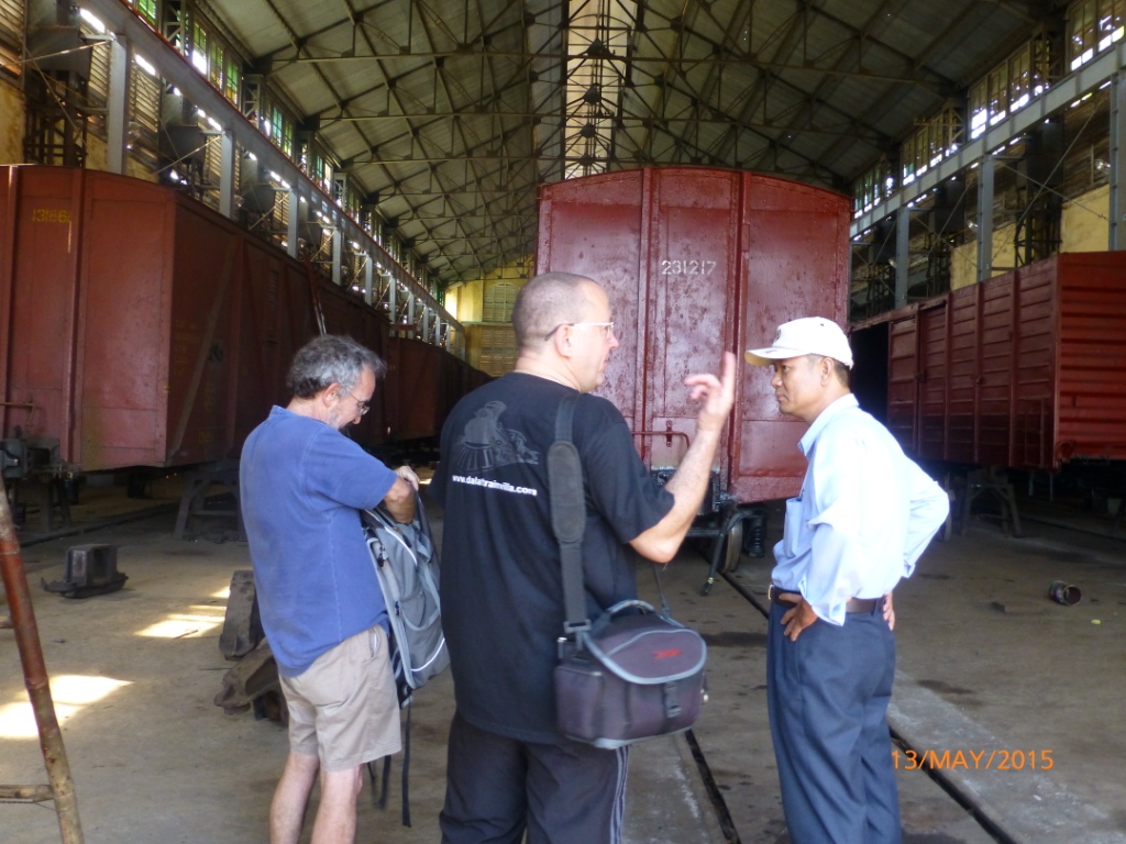
Not long after settling into teaching at the University of Technology in Ho Chi Minh City I made the trip to Dalat and explored much of the route as far as Dran. On the journey back to Saigon I left my camera on the bus and, surprise, surprise, no one from the bus company found it; so, no photos!
I made subsequent trips in 2010, 2011 and 2013 with further trips in April and May 2015.
For those people not familiar with Vietnam, Dalat or the route of the disused railway I have inserted a few maps for you to get your bearings.
Dalat Station
But how many people who visit the station, and perhaps go for a ride on the train, realize why such a grandiose building appears in a small town like Dalat? When I first visited there was a diagram of the entire route in the room opposite the ticket office but this has now disappeared.
The facade viewed from the platforms
The times of the trains to Trai Mat but they only run if there are enough passengers - run for the convenience of the staff, not the customers - how Vietnamese!
Don't be taken in by this Japanese locomotive which is a conventional one which used to run on the main Saigon to Hanoi line and possible from Thap Tram to Song Pha. There is a similar one displayed at the station in Saigon but ......
..... not many people notice this short section of cog track just behind the locomotive; the only piece surviving from the 34km that were laid!
 |
| Another carriage being refurbished in April 2015 |
Dalat to Trai Mat
The track heads to Trai Mat from the bridge on Tran Qui Cap Street
These motorcyclists thought they would take an easier route but were trapped between the rails when the train approached. Eventually they laid the bikes on their sides and dragged them over the rail - just in time!
The tourist train heads under the newly built bridge on road 723 which is now the main route to the coast and Nha Trang
The last tourist train of the day heads back to Dalat
Trai Mat Station
The level crossing at Trai Mat
The 'new' station with the distance of 77km 450m from the start of the route at Thap Cham
 |
| The new coaches at Trai Mat in 2010 |
 |
| The tourist train offloads its passengers at Trai Mat in 2010 |
 |
| 'Tickets please!' |
Trai Mat to Da Tho (le Bosquet) Cog rail @ 60 0/00
Da Tho Station
Looking from the road side
The ticket office
The fireplace in the waiting room
The kitchen stove?
Looking back towards Dalat
Typical ceramics above the door leading out to the platform
 |
| Photo of what was probably the toilet taken in 2013. By April 2015 this building had been refurbished as some kind of storage facility. |
At April 2015 it wasn't possible to access the main building as the interior was full of tree branches.
Da Tho to Tunnel 5
Its possible to drive along the trackbed for some distance but just beyond this photo the entire embankment and a culvert have been swept away. The water pipe has been left suspended over the void. There was no obvious way to walk round.
 |
The area of the collapse photographed from the road above in April 2015
It was reported in May 2015 that the breach had been partly repaired so that it is now possible to ride a bike over it. |
Tunnel 5
The near end
Note water pipe along side
The far end, clearly visible from the road
Tunnel 5 to Tunnel 4
The track bed used for bee hives
Tunnel 4
Coffee bushes planted on the track bed just before the tunnel entrance.
 |
| Looking forward |
Tunnel 4 to Cau Dat (Entrerays)
 |
Tunnel emerges in valley among tea and coffee plantations
 |
| The track bed passes under Cau Suoi Duc |
 |
| The Cau Suoi Duc passes over the track bed. Photo taken from Cau Dat direction |
|
Cau Dat Station
The view from the road
Looking down from behind the station
The station sign again with matching ceramics
 |
| Ceramic tiles similar to those at Da Tho station |
Both Da Tho and Cau Dat stations appear to be built to a higher specification than most of the others. Perhaps this reflected the more prosperous clientele? At April 2015 the main rooms were being used for storage but the owner was not available to let us look around. This station could be refurbished as a 'visitor centre'. It has room for parking in front.
 |
| Inside the main station in May 2015 |
 |
| Despite visiting this station many times this was the first time I realised there is also an engine shed at the rear. |
 |
| Birds nesting in the roof of the engine shed |
 |
| This notification of the altitude will have said 1466m |
Cau Dat to Tunnel 3
Bridge over the railway in Buu Dien Village
Tunnel 3
On my earlier visits the tunnel portal could be clearly seen from the road above. By 2015 it was obscured by high bamboo and grasses, however a new concrete 'agricultural' road had been constructed (partly along the track bed) to within about 30 m of the portal. In April 2015 the reservoir nearby was dry's a bone.
 |
In contrast to visits in 2011 and 2013 when there was deep water and the tunnel was inaccessible, in April 2015 the approach to the tunnel was dry. It appeared that it would have been possible to walk through the tunnel if properly equipped.
On previous visits my Easy Rider guides had both said that the tunnel was blocked by a collapse. Why? |
 |
| The team assembles in May 2015 to try to go through the tunnel. L-R the author, Howard Prosser, Curtis 'King' Covach and his wife |
 |
| Improvised waders (waste of time!) |
 |
| The raised walkway soon disappeared under water |
 |
| Approaching the far end of the tunnel the water and mud got too deep and the discovery of a dead pig in the water forced a retreat |
 |
| Curtis retreats from the dead pig! |
 |
| Returning, defeated, to the Cau Dat end of the tunnel |
 |
| Easy access now available at this turning not far up the hill out of the village |
Tunnel 3 to Tram Hanh (Arbre Broye)
 |
| Approaching Tunnel # 3 from Tram Hanh |
 |
| The portal |
 |
| Accumulated silt and farmer's dam with trench dug on RHS for drainage pipe |
 |
| Drainage pipe in wall shows original level in trench |
 |
| The intrepid team showing blockage and dam in entrance |
 |
| Pipe in trench outside tunnel portal |
Tram Hanh (Arbre Broye) Station
The turning off the main road that leads down to the station
 |
| Track bed but no obvious station building |
Tram Hanh to Don Duong (Dran). Cog rail @ 115 0/00
This is the steepest (at 115 o/oo) of the cog rail sections where the route zigzags under two bridges. From Dalat it goes below the Treo bridge then curves around and goes under the Heo bridge before the descent to Dran.
 |
| Cau Heo |
 |
| Below the '2014' sign it is possible to see the column of a previous bridge structure (presumably made of steel and hence sold for scrap) |
Cau Heo
The route has descended from under Treo bridge and passes through this rock cutting before going under the Heo bridge.
A farmer has laid a concrete path down the trackbed as it heads down to Dran
As far as I dared go towards Dran
Looking back up to the road. This is the same valley that goes under the Treo bridge
Looking back up to the Treo bridge from further down the road to Dran
Don Duong (Dran) Station
+Station+(4).JPG)
Don Duong (Dran) Station to Eo Gio (Belleview)
 |
| All that remains of the Dran Bridge as seen from the road bridge. |
 |
| The bridge columns as seen from the Bellevue side. |
 |
| The ridge abutment is now used as a cow shed. |
 |
| The old guard tower which overlooks the bridge and the track to Bellevue. |
Eo Gio (Bellevue) to K'Beu (Kabeu) including Tunnel # 2. Cog rail @ 120 0/00
Bellevue station is well preserved and has been sub-divided to produce a lot of accommodation. It appears to have had two platforms as there are canopies on both sides of the building.
 |
| Bellevue engine sheds from west end |
 |
| Engine sheds. Mr Thai is on the main track bed |
%2BStation%2C%2Beastern%2Bentrance%2B(see%2B'A'%2Babove%2Bdoor)%2B.jpg) |
| Eastern entrance. See 'A' above doorway. |
%2BStation%2Bfrom%2Bmain%2Broad.jpg) |
| Approaching Bellevue station from the main road |
%2BStation.jpg) |
| Station sign also showing old Vietnamese script (?) |
%2BStation.jpg) |
| Canopy over track bed on south side of main building |
%2BStation.jpg) |
| See entrance 'B' above doorway |
%2BStation.jpg) |
| Two door access on south side. |
%2BStation.%2BUnclear%2Bsign.%2BBottom%2Bsays%2B'Salle%2BAttente'..jpg) |
| Bottom part of sign, to right of picture above, says 'Salle Attente' |
 |
| 'Attente' |
.jpg) |
| Approaching Tunnel # 2 from Bellevue station. |
 |
| Tunnel # 2. See stone and concrete lining. |
 |
| Central bridge column immediately after Tunnel # 2. This structure is not shown on the Mekong Express map # 5 |
 |
| Looking back to K'beu end of Tunnel # 2 from east, valley, side. |
.jpg) |
| Central bridge pier from western, mountain, side overlooking valley. |
.jpg) |
K'beu end of Tunnel # 2 from south side.
 |
| Part of Bellevue to Song Pha route seen from main highway. |
|
 |
| Road works on main highway in 2013 |
K'Beu (Kabeu) to Song Pha (Krongpha) including Tunnel # 1. Cog rail @120 o/oo
A hike was arranged by Curtis King on Monday 13th April 2015 to locate Tunnel # 1 from Song Pha station.
 |
| The K'Beu end of Tunnel # 1 |
 |
| Second structure up from Song Pha |
 |
| Last structure (4th) before Tunnel # 1 |
 |
| Retaining wall just before Tunnel # 1 |
 |
| Third structure after Song Pha |
 |
| Fourth structure after Song Pha |
 |
| Approaching Tunnel # 1 from Song Pha |
 |
| Inside Tunnel # 1 |
 |
The author didn't make it into Tunnel # 1
 |
| The K'beu end of Tunnel # 1 |
|
Song Pha (Krongpha) Terminus
 |
| Arrival hall for 'adhesion' trains from Thap Tram? Inspection pits have been filled in. |
%2BStation.jpg) |
| Departure hall for 'cog' trains to Dalat? |
 |
| Arrivals building from edge of new canalised river |
 |
| Departures building from Dalat end |
 |
| Political inscription inside arrivals building. |
 |
| River diversion being dug in 2013 to north of station |
Song Pha (Krongpha) Terminus to Tan My (adhesion track)
 |
| Tan My Bridge seen from the main road bridge |
 |
| Bridge from Thap Cham end. 9 spans of 20m (?) |
 |
| Tan My Station - not very impressive! |
Tan My to Dong Me (adhesion track)
Dong Me to Thap Tram (adhesion track)
Thap Cham Station Maintenance Works


.jpg)


+Station.jpg)
.jpg)


+Station+at+1015.73m+elevation.JPG)
+Station+(2)+looking+towards+D'ran.JPG)
+Station+(3).JPG)
+Station+(4).JPG)


The railroad historian and author, James D. Porterfield is interested in writing on the project to restore the cog railway that Curtis spoke to us about when we were in recently in Vietnam. He is on Facebook, and his blog "The Railroad Tourist" is also on Facebook. He is also the Director of the Center for Railroad Tourism at Davis & Elkins College, in West Virginia, USA, and the author of several books. Hope you can get in touch and that it helps!
ReplyDeleteWhat a fabulous blog and such amazing photos. They really show the magnitude of any project to completely restore the old cog railway. Thank you!
ReplyDelete